Cost-Effective, Continuous Geospatial Intelligence
Get high-resolution, wide-area geospatial intelligence without the cost and gaps of traditional satellite or drone solutions.
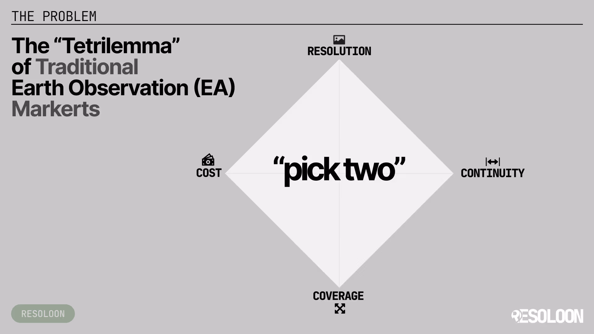
Did you know the whole market forces you into bad trade-offs?
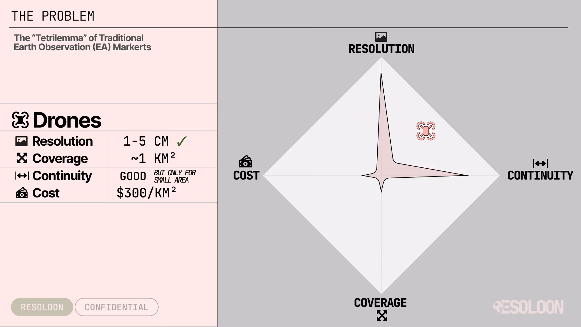
Drones
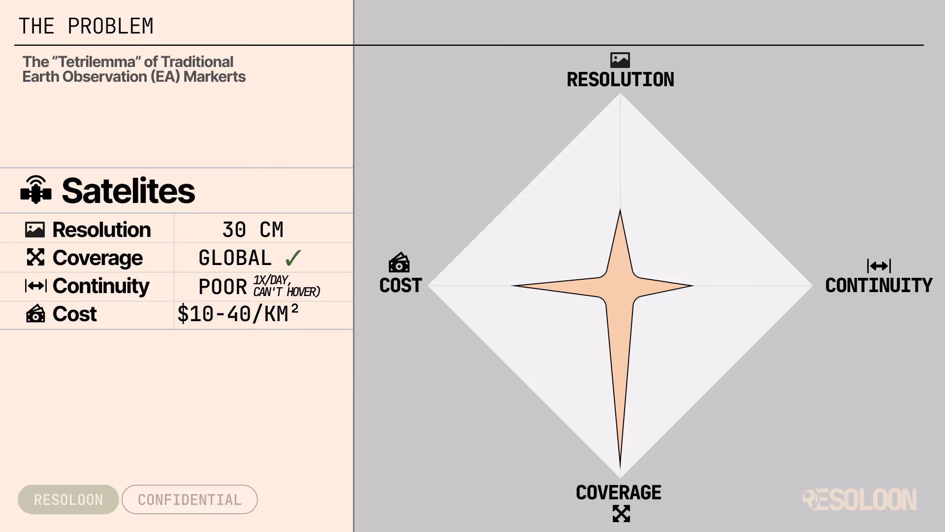
Satellites
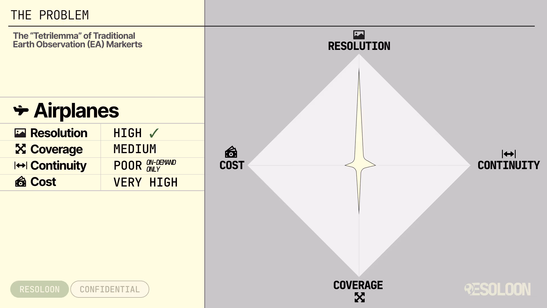
Airplanes
The “Tetrilemma” of Traditional Geospatial Intelligence
Pick two. You always lose the third.
Whether you rely on drones, satellites, or aircraft, you’re always stuck with the same compromise:
You can’t have high resolution, large coverage, continuous monitoring, and reasonable cost at the same time.
Drones
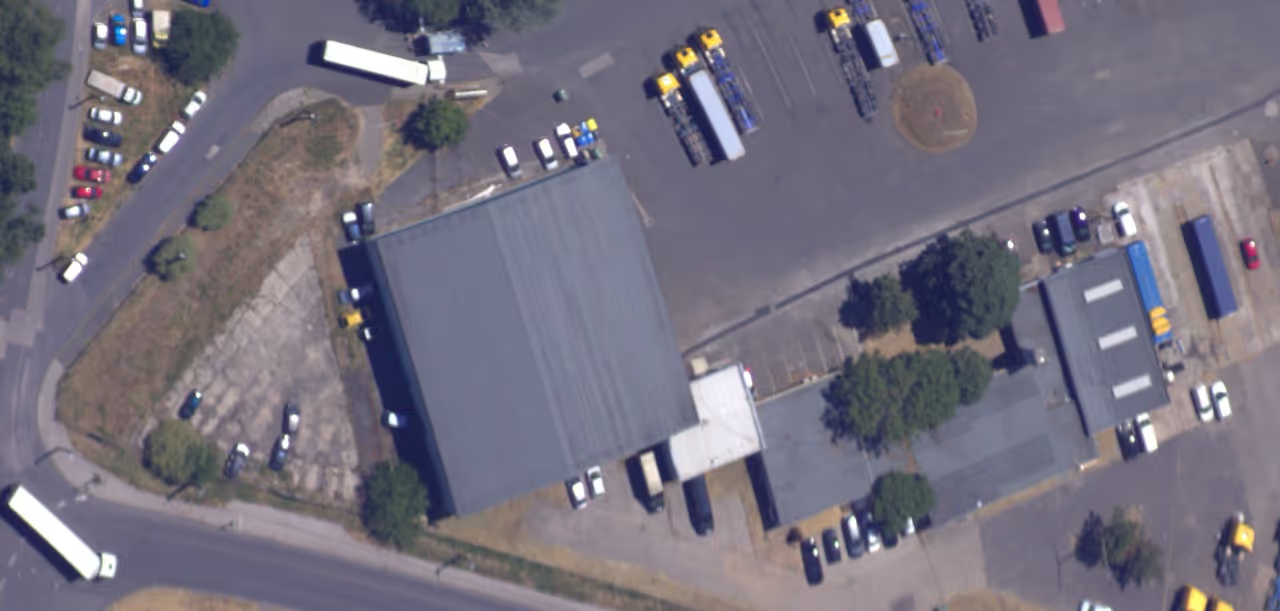
Amazing detail.
Tiny coverage.
Expensive per km².
They scale poorly and require constant human operations.
Great for close-ups, but impractical for continuous, large-area intelligence.
Satellites
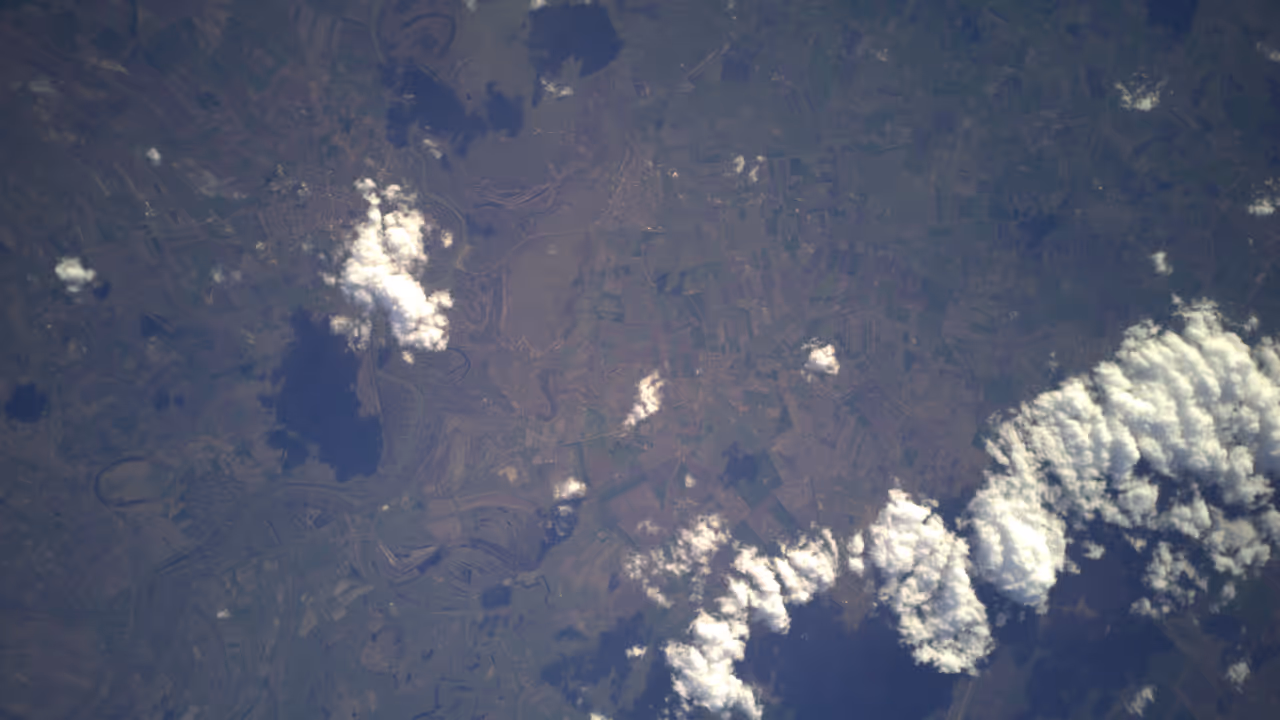
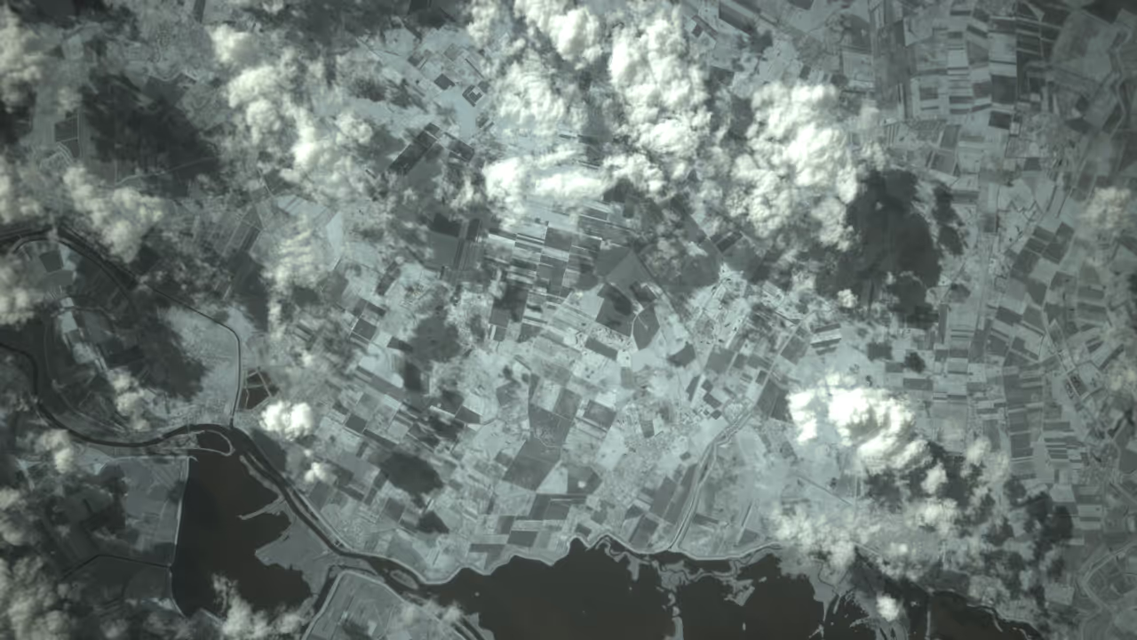
Great coverage.
Low revisit.
Limited detail or high cost.
You get snapshots, not presence.
Either the data is cheap and coarse - or detailed and expensive, with long gaps between updates.
Airplanes
Great sensors.
On-demand only.
Very expensive.
Powerful for specific missions, but not scalable or cost-effective for continuous geospatial intelligence.
Most teams are forced to choose between cost, detail, scale, and timeliness - and live with blind spots, delays, or high budgets.
You either:
-
Miss critical changes because updates are too slow,
-
Or can’t see enough detail to act,
-
Or can’t afford to monitor the area properly,
-
Or can’t do it continuously.
So decisions are made late, with incomplete information, or not at all.
Built for Organizations Responsible for Large, Critical Areas
Deliver persistent, wide-area geospatial intelligence without the cost and gaps of traditional satellite or drone solutions.
Monitor change over time, detect emerging risks, and support better decisions with affordable, always-on situational awareness- designed for large territories and long-term operations.
One Platform.
No Trade-Offs.
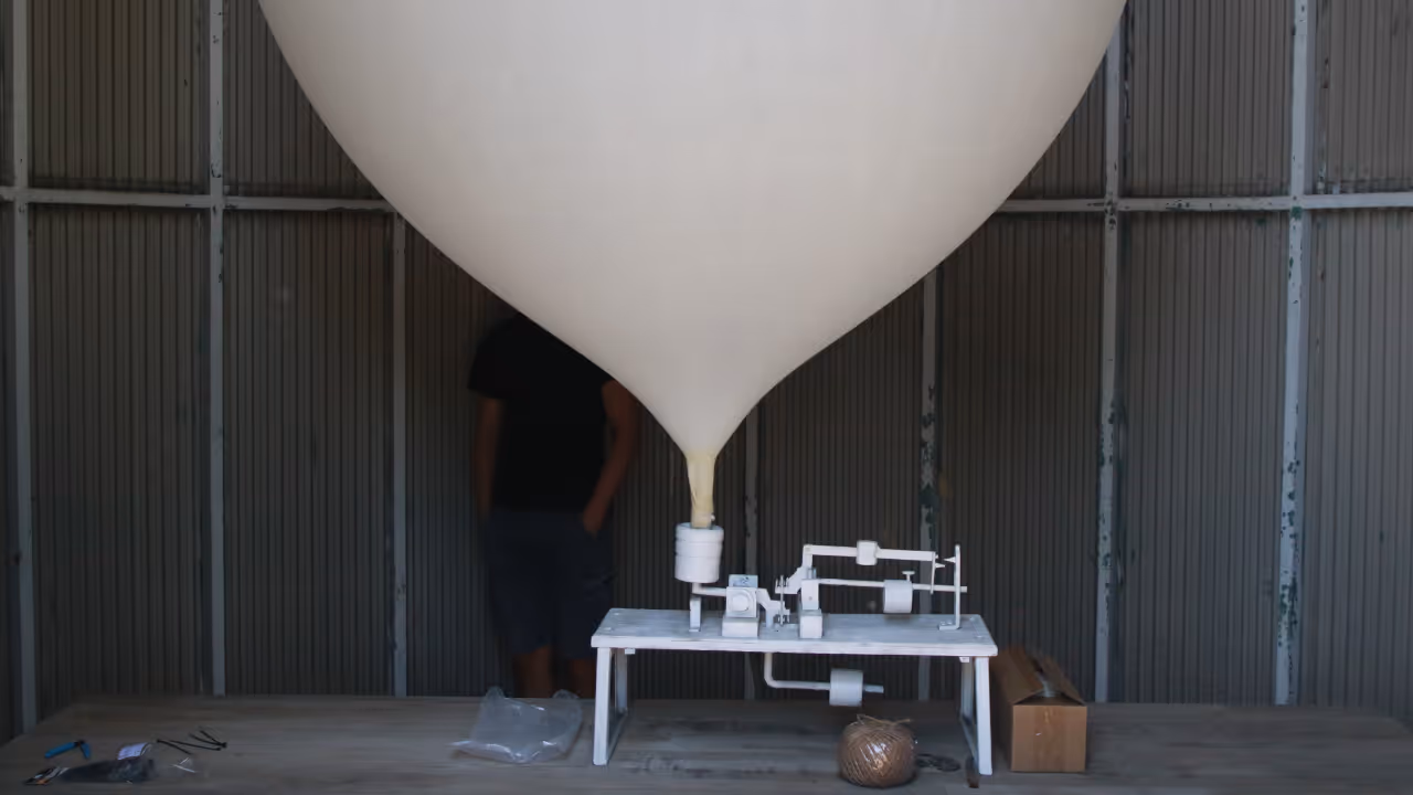
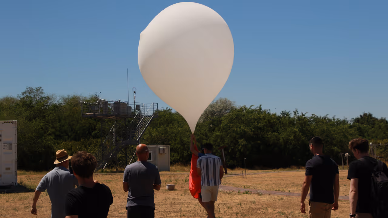
Resoloon focuses on high-altitude, navigable balloon platforms operating around 30 km above Earth.
This enables long-endurance, wide-area, high-resolution observation that neither drones, satellites, nor aircraft can deliver in a cost-effective way.
You can detect changes earlier, respond faster, and make decisions based on what’s happening now - not on outdated snapshots or incomplete coverage.
The result: lower risk, faster response, and better decisions at scale.
Related Posts

Why Earth Observation Is Expensive & How Resoloon Fixes ItQuick introduction
Traditional satellite imagery forces you to choose between cost, coverage, and detail. Resoloon delivers high-resolution monitoring without the tradeoffs.

Why Earth Observation Is Expensive & How Resoloon Fixes ItQuick introduction
Discover how Resoloon made the Forbes 30 Under 30 2026 list. From high-altitude balloons to the Forbes cover, go behind the scenes of our startup journey.
50 cm resolution
See early signs of ground subsidence, soil movement, and small-scale construction activity before they become critical.
800 km² coverage
Monitor entire pipeline sections and surrounding risk zones - not just isolated points or short segments.
1-day continuity
Stay up to date with evolving risks instead of relying on weekly or monthly snapshots.

~$0.50 / km²
Make continuous, large-scale pipeline monitoring economically viable - not just occasional inspections.
Persistent Monitoring Without Constant Operations

AI Navigation System
We use a proprietary wind prediction model to keep our high-altitude platform over your pipeline corridors for extended periods.
This enables continuous monitoring of critical sections without constant human control or repeated drone missions.

Optical & Thermal Imaging
Resoloon uses high-resolution optical sensors to detect ground subsidence and terrain changes.
This makes it possible to spot small but critical changes across long pipeline sections.

Analytics & Data Platform
We turn raw aerial data into maps, measurements, change detection, and alerts tailored to pipeline monitoring - so your team can focus on decisions, not data processing.
What We’ve Already Built
6 successful stratospheric missions completed
50 cm ground resolution achieved
1-day flight duration achieved (with 800 km² coverage)
End-to-end analytics pipeline operational
Wind model validated
Meet our team

Worked on autonomous underwater quality assurance submarines.

Worked in advisory and in startups.

Theoretical physicist who worked on airplane navigation optimization

Built precision embedded data processing systems.

Built space grade electronics and military drones.

Designing and building hardware systems
Book a short discovery call
with us to walk through your area, your constraints, and your goals. We’ll tell you honestly whether Resoloon is a good fit - and if it is, we’ll outline a pilot setup tailored to your needs.
What Happens After You Book a Call
Quick introduction
We start by understanding
what area you’re responsible for, and
what problem you’re trying to solve.
Your problem & constraints
You walk us through:
what you’re monitoring today
what’s not working with your current setup
what matters most: resolution, coverage, speed, cost, or continuity.
We map possible solutions
Based on your use case, we explain:
whether Resoloon is a good fit
how a pilot could look for your area
what’s realistic today - and what’s not (we’ll be honest)